6 Days Qinghai Trip Report
The Tibetan Plateau, also known in China as the Qinghai–Tibet Plateau or the Qing–Zang Plateau, was not significantly affected by the COVID-19 pandemic. Qinghai province had only 18 cases at its peak, while the Tibet Autonomous Region had just one single case. All these cases were imported from central China. Apart from these few imported cases, the Tibetan Plateau has remained COVID-free since the very beginning of the pandemic. Therefore, we can surely call this region the safest travel destination in China (and, probably, even in the whole world!).
The reopening of domestic tourism in China has led to a growing demand for tours to the Tibetan Plateau. The unique Tibetan culture, with its ancient monasteries, vast grasslands, and breathtaking plateau sceneries, attracts more and more travelers who are ready to immerse themselves in new adventures after long months of continuous quarantine.
SnowLion Tours arranged this 6-day tour in Qinghai province right after the restrictions related to COVID-19 were lifted on a cross-provincial level. To give a glimpse or a basic idea of what such a tour is like, we are posting this brief itinerary report of one of our recent trips arranged in July 2020.
Day 1:
We drove from Xining to Kumbum Monastery, located 25 km south of Xining, which takes about 40 minutes to reach. Kumbum is the largest and most important monastery in Qinghai province. We spent around 3 hours visiting all the temples inside. After having lunch in a local Tibetan restaurant, we headed to Qinghai Lake. Also known by its Mongolian name, Kokonor Lake, it is the largest salt lake in China and is located 150 km west of Xining city. We did not go to the main entrance of the lake area. Instead, we took a side road and drove all the way to the lake shore. This is our normal practice to avoid crowds at the main entrance gate and save time.
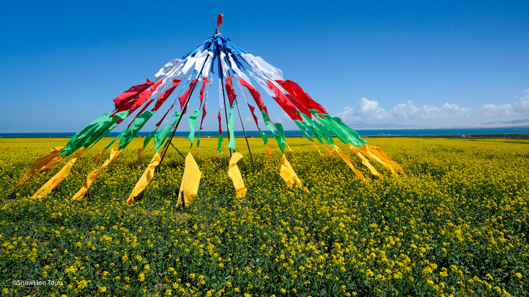
It is the season of rapeseed flowers now, so the whole shore is like a furry yellow blanket. The view is mesmerizing, with the contrast of the yellow meadows and the blue waters of the lake. Seagulls and black-necked cranes are flying by the shores, and locals are grazing their sheep – Kokonor shore views are stunning. Afterwards, we drove up to the top of Serchen Mountain, from where we could see an overview of the lake. Then we continued driving to Chabcha to spend the night at a local hotel there. Many nomads set their camps there, too.
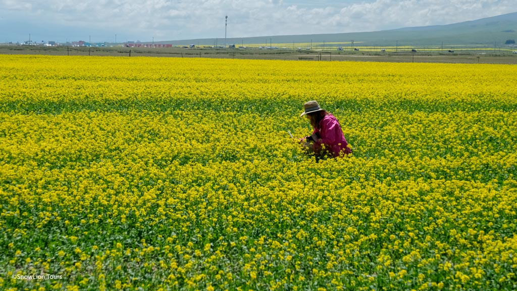
Yellow flower field at the Qinghai Lake shore.
Day 2:
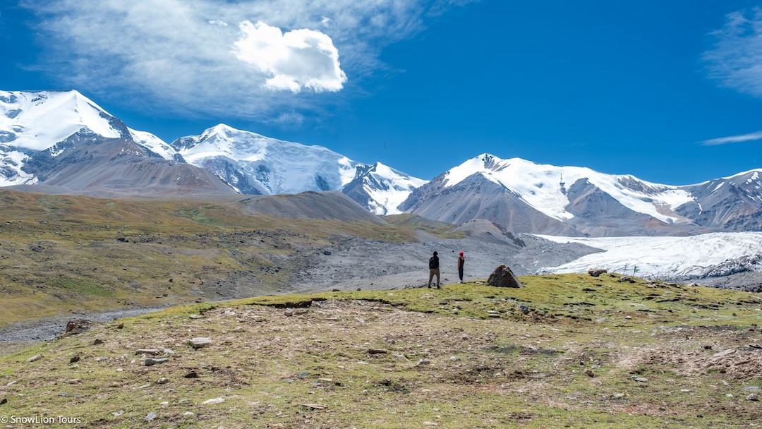
Our morning began by driving from Gonghe county to the sacred Mount Amnye Machen. This 320 km road took around 6 hours of driving. We also had several stops along the way to enjoy the view. Mount Amnye Machen is the highest mountain in Qinghai Province. This majestic mountain, covered in snow year-round, is also one of the four holiest mountains of the Tibetan Plateau. The other three are Mount Kailash in Western Tibet, Mount Kawa Karpo in Yunnan Province, and Mount Minyak Gongkar (Mount Gongga) in Sichuan Province. We got off the main road to find a trail leading us to the very bottom of the snow mountain. There, we found a beautiful site next to the river and set up our camp. It was a joy to witness a glorious sunset blazing with fabulous colors reflecting on the top of the glacier’s peak. After the sun went down, the stunning view of the clear night sky, with its veil of shining stars, inspired us beyond words.
Day 3:
We explored the area around Mount Amnye Machen. Here, one can either go hiking to the glaciers or drive behind the mountain to enjoy a different view of it. We chose to stay at the campsite and enjoyed several short hikes around.
Day 4:
After seeing a beautiful sunrise at Mount Amnye Machen, we drove to Machen county of Golog Tibetan Prefecture. From there, we continued to Gui’de county, which is located on the bank of the Yellow River. On the way, we visited Ragya Monastery and the scenic red clay mountains.
Day 5:
In the morning, we drove to Kanbula National Park, also known by its Tibetan name as Kamra Park. This national park offers some of the most beautiful sceneries around Xining. We spent a few hours hiking between the towering red clay mountains and also visited Achung Nandzong Nunnery. Originally, it was a small hermitage consisting of a few meditation caves, which later expanded to a nunnery. Those ready for a hike on the steep rocky trail will be rewarded by reaching the temple of the Buddha of Compassion, located at the top of the red clay mountain. Afterwards, we drove up to the Tibetan villages, from where we could see another highlight of Kanbula National Park – a huge turquoise lake deeply nested in this vast valley. There are several places to stop while descending from the villages back to the town.
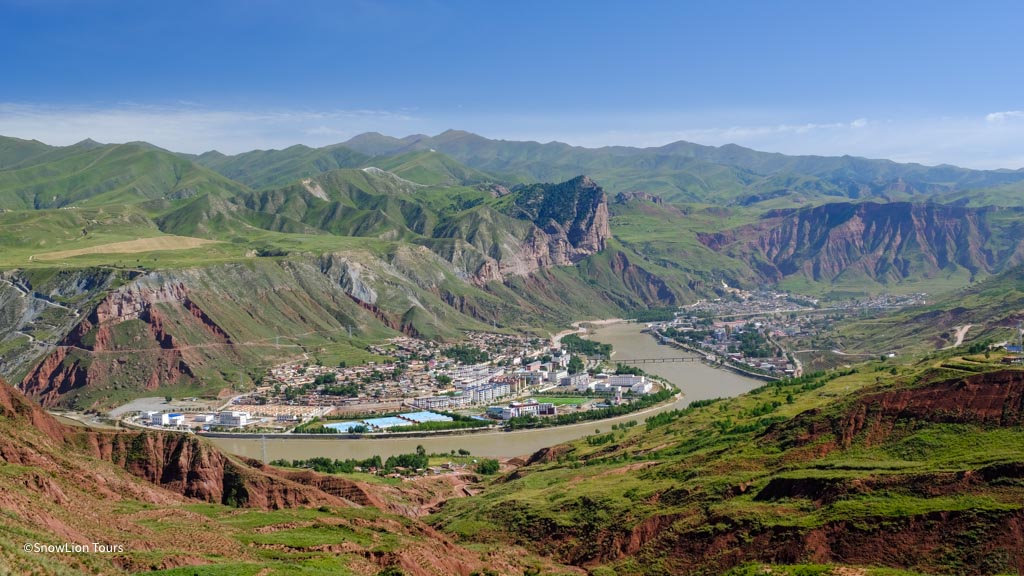
After crossing the Yellow River, we continued driving on the narrowing road up to the mountain where Shachung (Jakhyung) Monastery is located. Shachung is one of the oldest monasteries in Qinghai province. It is very famous for raising one of the most important figures of Vajrayana – Lama Tsongkhapa, the founder of the Gelug school of Tibetan Buddhism. Additionally, due to its location on the very top of the mountain, Shachung Monastery offers one of the best views of the Yellow River. In the evening, we finally returned to Xining. We were quite tired but very happy.
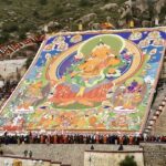
On the last day of this tour, we visited the Tibetan Medical and Cultural Museum, which is the most authentic and largest Tibetan museum in the world. It is located on the outskirts of Xining city. There are two main exhibitions. One part of the museum is dedicated to ancient Tibetan medical heritage, astronomy, astrology, and science. The other part focuses on Tibetan religion and culture. Many visitors come here to see the 618-meter-long thangka scroll, the longest in the world, depicting the entire history of Tibet. The whole visit to this museum takes about 3 to 4 hours. Our tour ended by driving to the airport as our clients had a flight to catch. Alternatively, the journey can be concluded by dining in a local restaurant or watching a Tibetan musical performance in one of the local “nangma” bars


.jpg "amdo monlam festival tour")
