The Tibetan highland is the largest and most elevated plateau in the world. Almost everywhere, it rises above 4 kilometers, and even more impressive is the fact that this highland is a vast space that could fit the whole state of Mexico or Kazakhstan, not just a separate mountain peak or chain. The easiest way to imagine Tibet is to think of an oval table of great height standing on the “floor” of Eurasia. It is so high that even the tallest mountains in the world, the Himalayas and Kunlun ranges, seem small when viewed from the highland, while from below, from the plains, they look like impassable walls rising several kilometers high. The ridges within the Tibetan plateau also look modest, almost like home, while their absolute height reaches 6-7 kilometers.
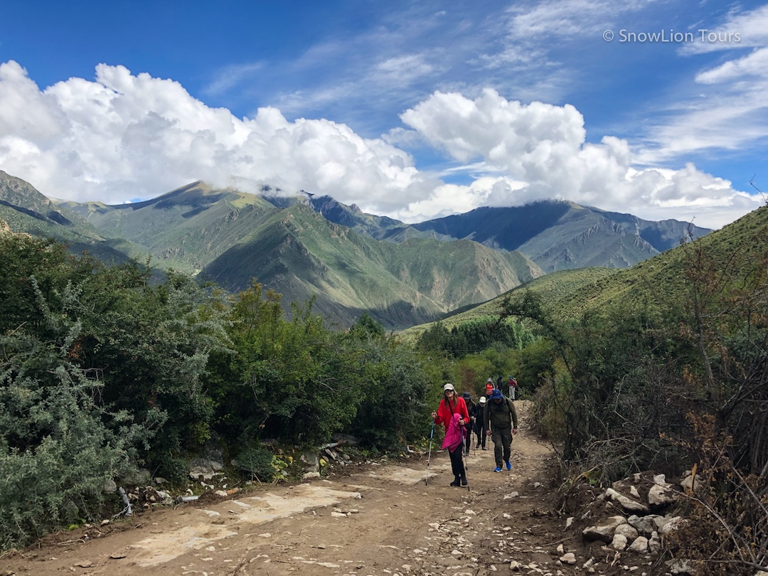
Hiking to Drak Yangdzong
From space, the “tablecloth” on the “table” has three colored areas: in the middle, there is yellow-green steppe, in the northwest, terracotta desert, and in the east, a patchwork of snow, dark green forests, and emerald meadows.
Endless green meadows where yaks and antelopes sweep past the trains heading to Lhasa, and the mountains are barely visible in the haze on the horizon. The grass is filled with water so that reflections of the sky appear here and there. The water has nowhere to flow: the permafrost is hidden under the ground, creating something between a meadow and a swamp. But the water still moves slowly. First, transparent streams merge with each other, and out of them, like out of a wizard’s sleeve, appear the great Asian rivers: the Yellow River, Yangtze, Mekong, Salween, and Brahmaputra. This landscape occupies the entire central part of Tibet, from the Himalayas to the Nanshan Mountains. World-famous inhabited sites of Tibet are located here. “Inhabited” does not mean there are many people in the area; in fact, it’s hard to see people in the countryside.
A continuous chain of the Himalayas goes through Tibet in a long arc from the south. But the great rivers of Asia were slowly able to get through this barrier, so the highest mountains of the world, oddly enough, are not a watershed. Previously, Tibet was a plain with small mountains. Relatively recently in a geological sense, the Indian tectonic plate came from the south and began to crawl under the Eurasian plate. This elevated Tibet over the clouds. At that time, the highest mountains of the world—the Himalayas—also began to rise. This was already during the age of mammoths. The Himalayas are still growing, generating earthquakes, and releasing hot springs and radon from the depths to the surface.
Anyone who has seen the majestic peaks of the Himalayas from India and Nepal cannot help but be surprised when looking at them from Tibet. The mountains are still high and icy, but it looks like someone hid many kilometers of foothills with luxurious forests, leaving only cold peaks. “The next day, reaching the top of the pass, we were surprised to find that there is no descent. It seemed we were looking into infinity that is impossible to cross. There were no signs of life anywhere, only a cold wind blew through the land.” This is how the pass through the Himalayas is described in the book Seven Years in Tibet. And it is really how it feels.
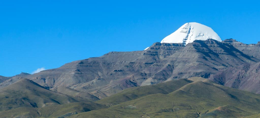
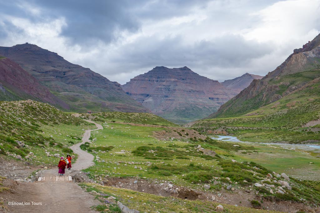
The mountain system that is home to Kailas, a mountain sacred to followers of four religions, cannot escape worldwide fame. The Trans-Himalayas are several ridges north of the Himalayas which extend in the same direction, from east to west. To the north are the cold deserts of the Changtang highlands, and to the south, near the Himalayas and the Nepalese border, are lower and more populated areas, but even there, the life of Tibetan herdsmen is quite harsh. Yet, the severe climate does not stop thousands of pilgrims who come to make kora, the ritual circumambulation around Kailas.
Hindus believe that Kailas is the abode of Shiva and that four great rivers flow down from the mountain. This is an exaggeration: all water from the top of Kailas flows only to one river, the Sutlej, through Lake Langatso. The other three rivers, although relatively close, receive their water from other peaks of the Trans-Himalaya.
Snow-capped peaks of the six-thousand-meter-high Tangla Ridge divide Tibet into the northern and southern halves. It also serves as the administrative boundary between the Tibetan Autonomous Region (in the south) and the province of Qinghai (in the north). Tibetans on both sides of the ridge are so different that they even speak different dialects. Although the ridge does not look very large and in many places it is easy to cross, the world’s highest point of the railway to Lhasa (5231 m) also lies here. The easiest way to have an outer space experience without actually getting into space is simply to get out of the car on the way to Lhasa on the Tangla pass. A few minutes are enough.
North-Eastern Tibet seems to end with a vast desert in the Tsaidam depression. Historically, this was the main road to Tibet from China and Mongolia, and now there is a highway and a railway. But before the desert starts, the last mountains of Tibet—the Nanshan—rise to the north. They’re unusually green. In the mountains, one can see both traditional Tibetan steppe and spruce forests, and most importantly, the landscapes of Zhangye-Danxia, which these mountains are known for all over the world. These are natural bands of multi-colored rocks, almost like a rainbow, covering tens of kilometers of mountains. It feels like you’re in a giant kaleidoscope. Behind Nanshan, the plains begin.
The largest northwestern part of Changtang—the “table” of Tibet—is covered with blue lakes spread among lifeless beige and terracotta-colored desert. There are still no cities or people here. To get deep into the Changtang is not easier than into Antarctica. There is only one way from Uighur lands to Lhasa (the Western Tibet highway) that crosses the border zone of this vast region. It is one of the most inhospitable places on Earth, but that’s why it is so attractive: a lot of wild animals that are easy to see even from the road on the endless plains, and a uniquely stunning sky, which one who saw it can never forget.
At the northern edge of Changtang (and Tibet), there are the Kunlun mountains with steep cliffs and almost as long as the Himalayas. These are high mountains with a very dry climate. People don’t live here. Towns and cities begin only on the plain in the oases of Uighur lands.
To the east, Kunlun does not descend, only becomes greener, and the place where it is crossed by the railway to Lhasa is very picturesque, although the climate is still harsh. And on the southern edge, there is a new road leading to the south of Qinghai province. Geographically, it is already within Tibetan heights, but it is much easier to get here than to Lhasa. In recent years, cyclists have been using this scenic road instead of the Hexi corridor to get from Central Asia to the plains of China.
The edges of Tibet are inevitably getting crushed under their enormous weight. From the north and the south, they are supported by Kunlun and the Himalayas, but from the east, there is nothing like that, and giant blocks slowly break away. At first, it is very hard to see anything but huge valleys of the great rivers separated by high ridges, but closer to the edge, begins an enthralling world of scattered valleys and plateaus.
Each plateau is a separate wonderland—with cities, villages, forests, fields, and lakes. Wildly flowing rivers make their way between them. The deepest gorges form. Until the mid-twentieth century, these lands were almost unreachable, and even now two neighboring plateaus might be inhabited by different ethnic groups.
This is the most picturesque part of the “table” of Tibet—Kham and Sichuan Alps. From space, one can see snowy “stars” on top of the highest ridges alternating with deep wooded gorges.
The Sichuan Alps are called the land of high peaks and deep gorges. These mountains are amazing. Although inhabited areas seem to be close at hand, and the land has been studied from top to bottom, there are still new peaks put on the map. That is because in the Sichuan Alps in the east of Tibet, very high peaks alternate with steep slopes, forming impassable valleys up to three kilometers deep. The great rivers of Asia converge here and flow within only a few tens of kilometers from one another.
Slopes and glaciers feature a severe climate similar to the Himalayan one. Although the mountains are not a solid wall and the path through them from China to Tibet is the shortest, due to the chaos of impassable gorges, it’s also the most beautiful and difficult to traverse.
The zest of these impenetrable labyrinths (aside from their mere presence) is the widest variety of animals and birds in Asia. A little further south, in Yunnan province, there are the world-famous Jumping Tiger Gorge rapids. The scenery with bubbling water cascades (that you can fortunately see from a safe spot) is literally breathtaking.


.jpg "amdo monlam festival tour")
