Sanjiangyuan
Source of Three Rivers Nature Reserve
Source of Three Rivers Nature Reserve, also called Sanjiangyuan Nature Reserve in Chinese, is an area of the Tibetan Plateau in Qinghai Province which contains the headwaters of three great rivers of Asia: the Yellow River (Huanghe), the Yangtze River (Jinshajiang), and the Mekong River (Lancangjiang). Parts of the area were protected as the Three Rivers Nature Reserve.
This nature reserve consists of 18 subareas, each containing three zones which are managed with differing degrees of strictness. In 2015, the Chinese government decided to implement a new national park system and created Three Rivers National Park, which is set to open officially in 2020. Along with wetland and water protection, other ecological values, such as grassland, forest, and wildlife enhancement, have also been presented as goals. To advance the goals of the nature reserve, uncontrolled or poorly managed mining, logging, hunting, and grazing have been curtailed. Foreign and other mining firms have replaced the uncontrolled miners, trees have been planted, and measures have been taken to protect endangered species. To protect the grasslands, pastoralists are not permitted to graze their animals in designated core zones, and grazing is supervised. In addition, residents have been resettled from core zones and other grassland areas of the source area, and rangeland has been fenced and is in the process of being privatized throughout the three rivers source area. The source area is home to 270 species of wild land vertebrates, of which 69 are under state protection.
Researchers found 16 species under top national protection in the area, such as wild yak and snow leopard, and 35 species under Class Two national protection, including bharal and Tibetan gazelle. The number of snow leopards in the national park ranges between about 400 to 700. They have appeared in a wider area and been spotted more frequently in recent years. The reserve area covers the southern and eastern parts of Qinghai and has an area of about 50.4% of Qinghai Province. Included in it wholly or partially are 18 counties of the four Tibetan Autonomous Prefectures: Yushu, Guoluo, Hainan, and Huangnan, and Haixi Mongol and Tibetan Autonomous Prefecture. The reserve area’s population is about 600,000, 90% of which are Tibetan.
This nature reserve consisted of 18 subareas, and each contained three zones which were managed with differing degrees of strictness. In 2015, the Chinese government decided to implement a new national park system, and created Three rivers National Park, which is set to open officially in 2020. Along with wetland and waters protection, other ecological values, such as grassland, forest, and wildlife enhancement, have also been presented as goals. To advance the goals of the nature reserve uncontrolled or poorly managed mining, logging, hunting, and grazing have been curtailed. Foreign and other mining firms have replaced the uncontrolled miners, trees have been planted, and measures have been taken to protect endangered species. To protect the grasslands, pastoralists are not permitted to graze their animals in designated core zones, and grazing is supervised. In addition, residents have been resettled from core zones and other grassland areas of the source area, and rangeland has been fenced and is in the process of being privatized throughout the three rivers source Area. The source area is home to 270 species of wild land vertebrates, of which 69 are under state protection.
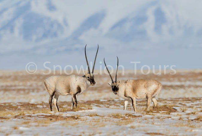
Tibetan Antelopes in the Sanjiangyuan Nature Reserve
Yellow River
The Yellow River is ranked as the second longest river in Asia. The term Yellow River translates from its Chinese name, Huang He. In Tibetan it’s called Machu. The Yellow River in China is 3,395 miles long, ranking as the sixth longest river in the world. The river carries over 1.6 billion tons of silt per year. The Yellow River has a total drainage area of about 290,560 square miles, which provides drinking water and irrigation to approximately 140 million people.
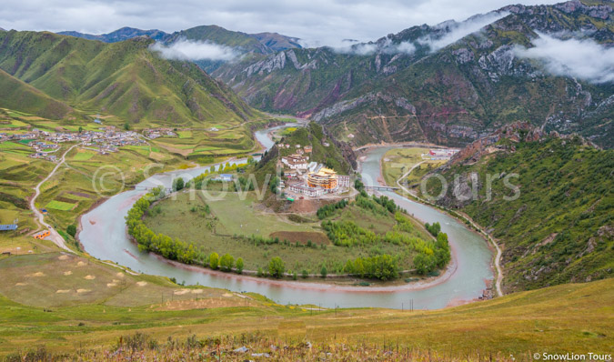
The Yellow River originates from the Bayan Har Mountains, where water flows through swamps and pastures steadily with a clear appearance. The river has three stages, of which different scholars have given variant opinions on the division of these stages. The Yellow River’s upper reaches begin at its source in the Bayan Har Mountains and end at Hekou Town in Inner Mongolia. This segment of the river is 2,157 miles long. The elevation of the Yellow River drops about 1,470 feet in this section. The upper stage includes two crystal clear lakes: Lake Kyaring with a capacity of 166 billion cubic feet and Lake Ngoring at 381 billion cubic feet. The middle reaches, where the Ordos Loop features a massive twist of the river, officially start at Hekou Town and end at Zhengzhou in Henan. This stage has a length of 749 miles and an elevation drop of 2,920 feet. The lower reaches begin at Zhengzhou and end at the river’s mouth where it drains into the Bohai Sea. The lower part of the river crosses the vast North China Plain by flowing for a distance of 488 miles.
Mekong River in Nangchen Yushu.
Yangtze River
The Yangtze River in China is the longest river in Asia and the world’s third longest river after the Nile and the Amazon. In Tibetan it’s called Drichu. It traverses through China, covering a total distance of 3,950 miles. It has a drainage basin of 698,266 square miles and drains all its waters into the East China Sea. The river originates from several tributaries in the eastern part of the Tibetan Plateau, two of which are commonly referred to as the “source.” Traditionally, the Chinese government has recognized the source as the Tuotuo tributary at the base of a glacier lying west of Geladandong Mountain in the Tanggula Mountains. It is the highest source at 5,342 m above sea level. The true source of the Yangtze, hydrologically the longest river distance from the sea, is at Jari Hill at the head of the Damchu tributary, approximately 325 km southeast of Geladandong. This source was only discovered in the late 20th century and is 5,170 m above sea level, just southeast of Chadan Township in Zadoi County, Yushu Prefecture, Qinghai. As the historical spiritual source of the Yangtze, the Geladandong source is still commonly referred to as the source of the Yangtze since the discovery of the Jari Hill source.
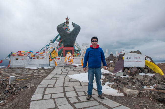
Yak Head monument at the source of Yellow River.
Mekong River
The Mekong is the 7th longest river in Asia and the 12th longest in the world, covering a total distance of 2,703 miles and draining an area of 307,000 square miles. In Tibetan it’s called Dzachu. The river flows through 6 countries: Vietnam, China, Laos, Myanmar, Thailand, and Cambodia.
The source of the Mekong can be traced to the Lasagongma Spring, which is a glacial stream in the Tibetan Plateau. The Lasagongma Spring has an elevation of more than 17,000 ft above sea level and flows into the Gaoshanxigu, which then drains into the Gouyonggu. The Gouyonggu later flows into the Zayaqu, followed by the Zaqu, which then becomes the Mekong River. The river becomes the Mekong River when it reaches the border between China and Myanmar. The Mekong snakes through six countries before draining into the South China Sea.
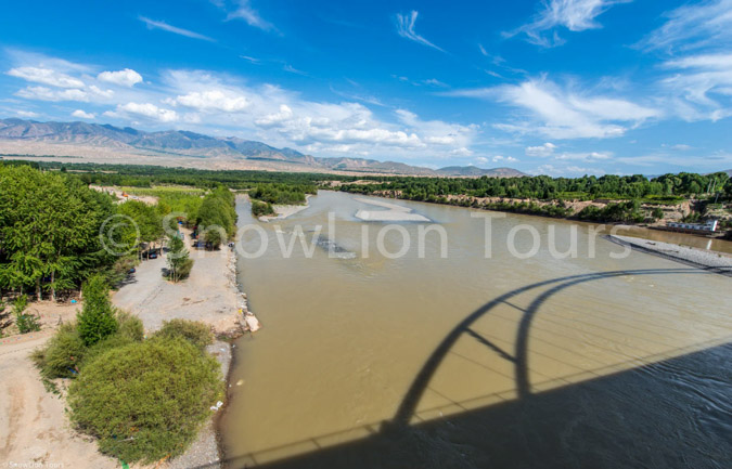
Yellow River at the Sanjiangyuan Nature Reserve
Recent Posts
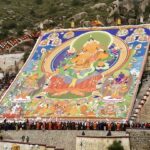
- Shoton Festival Begins in Lhasa!
 August 23, 2025
 - Tour Price in Tibet
 August 23, 2025
 - Qinghai Shaman Festival in Rebkong Concludes Successfully
 August 21, 2025
We are recommended by
We are committed to providing authentic, high quality, environmentally sustainable travel services. Join us and experience once in a lifetime holiday.
Recent Trips


.jpg "amdo monlam festival tour")
